

Quick Model Guide
The basics of operation, a solid foundation.

Visualise & Inspect

Interactive photo viewer & download

Measure Accurately
Virtually Inspect Like a PRO
Make use of the variety of assett viewing tools available including orbit, pan, zoom, and camera fly modes. Left click your mouse to view, use your mouse scroller zoom in and out or right click and hold your mouse for extra control. Use WASD keyboard buttons on your keyboard to manouvre more freely. You can even use the SHIFT button if your feeling extra speedy.


Click the Camera Button! (Bottom Right)
Effortlessly view and download original high definition images. Simply press on the photo icon located to the bottom right, and click anywhere on the site to locate area specific photos. Scroll through the gallery to find one that suits your needs best and download it with one click by pressing 'download' from the top toolbar.
Measure with leisure
Whether you want to measure the size of an entire building, the length and depth of steel, size of an opening or even measure something as small as an individual brick... The opportunities are endless. Length, Width, area, volume, angle. Gather data you always needed in just a few seconds.

Photos
3,633
Processing Time
12 Hours
Accuracy
+/- 1cm
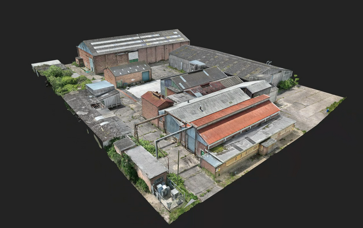
Project Summary
This challenging site, riddled with asbestos and derelict structures, was deemed unsafe for direct access. However, this did not deter us from conducting a thorough drone survey. Our advanced drone technology allows us to safely access even the most hazardous locations. We used three Ground Control Points strategically placed in safe areas away from dangers, and employed RTK correction services to ensure maximum geolocation and model accuracy. A total of 3,633 high-definition geotagged images were captured from various angles, heights, and distances, ensuring comprehensive detail and site coverage. After extensive office work and 12 hours of processing, the 3D model file was created and the live interactive reality capture viewer was up and running like a dream.
Select the photoviewer and click on any point of interest the model. Instantly, the original high-definition photos of that specific area will appear on your screen, allowing for detailed inspection and photo download. Our drones, combined with GNSS receivers corrected by an RTK service, accurately record the latitude, longitude, altitude, yaw, pitch, and roll, ensuring precise camera positioning and orientation. This capability allows for highly accurate measurements, with thousands of geotagged photographs stitched together to form a perfectly scaled 3D reality model of your site. This enables you to measure anything from horizontal and vertical distances to slopes, areas, and volumes. The possibilities are endless.